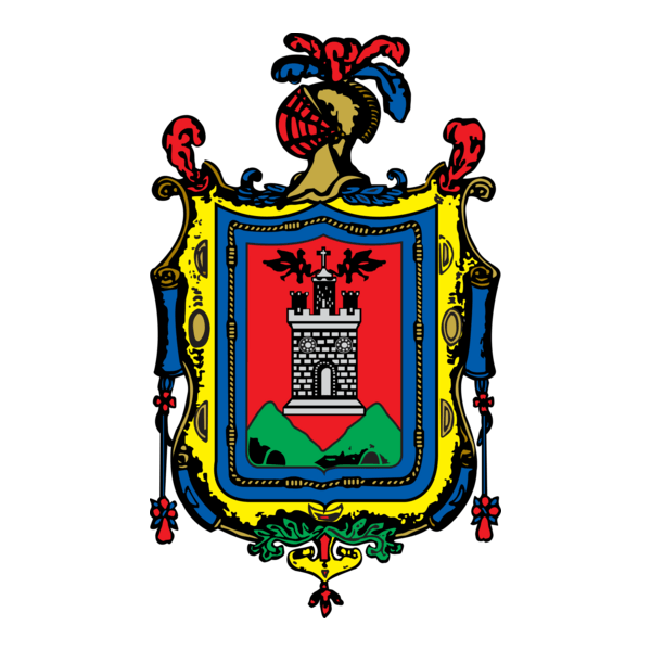
Quito, the capital of Ecuador, lies in northwestern South America. It was founded in the 16th century on the ruins of an Inca city and stands at an altitude of 2,850 m. Despite the 1917 earthquake, the city has the best-preserved, least altered historic centre in Latin America. The monasteries of San Francisco and Santo Domingo, and the Church and Jesuit College of La Compañía, with their rich interiors, are pure examples of the ‘Baroque school of Quito’, which is a fusion of Spanish, Italian, Moorish, Flemish and indigenous art (Source: UNESCO). Its coat of arms (Escudo de Armas de la Ciudad de San Francisco de Quito) awarded in 1541, appears to the left.
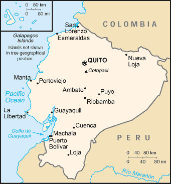
Quito, officially San Francisco de Quito, is located in northern Ecuador in the Guayllabamba river basin, on the eastern slopes of Pichincha, an active stratovolcano in the Andes mountains (see map). With an estimated population of about 2.1 million people as of 2007, Quito is the second most populous city in Ecuador, after Guayaquil. It is also the seat of the Quito Metropolitan District, home to 2 million residents, and the capital of the Pichincha province. As the headquarters of the newly-formed Union of South American Nations, Quito is also the de facto capital of South American integration. The city’s elevation is, on average, 2,800 m (about 9,200 ft), making Quito the second highest capital city in the world.
Quito is about 15 miles (25 km) south of the equator. A monument and museum marking the general location of the equator is known locally as la mitad del mundo (the middle of the world). Due to its high altitude and position on the equator, Quito has a constant, mild to cool climate year ’round. The typical high temperature at noon is 26°C (78ºF) and the typical night-time low is 7°C (55ºF). The average temperature is 15° C (64ºF). The city experiences only two seasons: dry and wet. The dry season, June through September, is referred to as summer; the wet season, October through May, is referred to as winter. Because of its location at the equator, Quito does not experience variations in daylight hours during the course of a year. Except for a few minutes resulting from a slight wobble in the earth as it rotates, sunrise and sunset are always at 6:00 a.m. and 6:00 p.m., respectively. Although it is in the same time zone as the eastern United States (except for the Galápagos Islands, which correspond to the U.S. central time zone), Ecuador does not switch to daylight savings time. It is interesting to note that while Ecuador is on the Pacific coast of South America, the city of Quito is due south of Pittsburgh, Pennsylvania.
(Text and map of Ecuador adapted from: Quito. From Wikipedia, The Free Encyclopedia)
Click on any picture for a FREE larger version. Read the licensing rules (REVISED) for your needs. There are hundreds of high quality free photos: use the Google/site search engine. See our digital photography tips : DOs and Don’ts; Choosing a Camera and Accessories , Taking Digital Photos, Downloading Photos, and Editing Photos. Visit Climate Change Facts to see for yourself if you are at risk from global warming.


%20waiting%20for%20customers%20at%20Parque%20Carolina%20in%20Quito,%20Ecuador&from=quito-ecuado)


%20Pollos%20al%20Carbon%20(chicken%20cooked%20on%20coals)%20make%20it%20difficult%20for%20American%20fast%20food%20restarants%20to%20compete.&from=quito-ecuado)


